
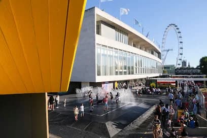
Royal Festival Hall
Southbank Centre, Belvedere Rd, London SE1 8XX
Upcoming Events at Royal Festival Hall
Getting to Royal Festival Hall
The closest stop is Waterloo Underground Station, about 3 minutes’ walk away.
Nearest stations
Waterloo Underground Station
- Bakerloo
- Jubilee
- Northern
- Waterloo & City
3 min walk207 m
London Waterloo Rail Station
- South Western Railway
3 min walk276 m
London Waterloo East Rail Station
- Southeastern
6 min walk503 m
Embankment Underground Station
- Bakerloo
- Circle
- District
- Northern
6 min walk515 m
Nearest bus stops
London Eye
- Bus
1 min walk45 m
Jubilee Gardens
- Bus
1 min walk86 m
Waterloo Station
- 381
- C10
- N381
2 min walk155 m
Waterloo Bridge / South Bank
- 1
- 139
- 172
- 176
- 188
- 243
- 341
- 59
- 68
- 76
- N1
- N171
- N343
- N68
- SL6
2 min walk156 m
Walking times are estimates. Powered by TfL Open Data.